이른 더위, 더 덥고 습한 여름의 징후? 기상청 "아니다"
Early heat sign of hotter, wetter summer? No, says weather agency The unusually warm early spring weather has sparked speculation that South Korea could face a long rainy season and extreme heat later this summer, as daytime highs in Seoul climbed to 28 degrees Cels
The Korea Herald
· 🇰🇷 Seoul, KR
Lim Jae-seong
EN
2026-04-17 16:32
Translated
이른 더위, 더 덥고 습한 여름의 징후? 기상청 "아니다"
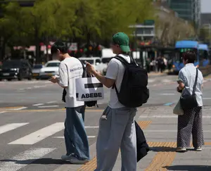
이례적으로 따뜻한 봄 초반 날씨로 인해 서울의 낮 기온이 이번 주 28도까지 오르면서 한국이 나중에 장마철과 극심한 폭염에 직면할 수 있다는 추측이 나오고 있다.
기상청은 이러한 우려를 일축하며 최근 기온 상승은 여러 기상 요인이 겹쳐 발생한 일시적인 현상이라고 밝혔다.
기상청 관계자는 목요일 정례 브리핑에서 "현재 기상 조건은 단기적인 기압 패턴에 의해 주도되며 여러 요인에 따라 여러 단계로 변화할 수 있다"며 "현재의 더위를 봄이나 여름 전반의 기온 추세의 전조로 보기는 매우 어렵다"고 말했다.
기상청은 극심한 폭염이 발생할지 여부를 판단하기에는 아직 이르다면서도 9월까지 기온이 평년보다 높게 유지될 확률을 50~60%로 예상했다.
기상청은 또한 소셜 미디어에서 6월 내내 계속적인 강우가 있을 것이라는 주장이 돌고 있다며, 이는 공식 예보에 근거한 것이 아니라고 강조했다.
기상청은 전통적으로 6월 말에 시작하는 장마철에 대한 장기 예보가 단기 강수 전망으로 대체되었다고 덧붙였다. 이러한 변화는 기후 변화로 인해 계절성 비전선의 변동성이 커져 전통적인 '장마' 기간의 개념이 약화되었음을 반영한 것이다.
기상청은 중국과 일본 역시 동북아시아의 장기적인 몬순 예보를 중단했으며, 한국은 2009년에 이러한 예보를 끝냈다고 언급했다.
최근의 따뜻한 날씨는 북쪽의 고기압과 남쪽의 저기압으로 인해 맑은 하늘을 가져오고 동풍을 유발하여, 습한 공기가 동쪽 경사면에서 수분을 잃은 후 내륙에서 따뜻해지고 건조해지는 '푄 효과'를 일으킨 것으로 분석됐다.
기압계의 변화가 예상됨에 따라 기온은 일요일 29도 정점을 찍은 후 다음 주에 누그러질 것으로 예보됐다.
월요일부터 4월 26일까지 낮 최고 기온은 전국적으로 17도에서 26도 사이로, 평년 평균인 18도에서 23도와 비슷하거나 약간 높게 유지될 것으로 예상된다.
처리 완료
2,042 tokens · $0.0039
기사 수집 완료 · 16:32
매체 피드에서 기사 메타데이터 수집
헤드라인 번역 완료 · 16:46
제목/요약 한국어 번역 (fetch 시점 inline)
kimi-k2.5
277 tokens
$0.00057
18.8s
본문 추출 완료
2,158자 추출 완료
본문 한국어 번역 완료 · 16:46
917자 번역 완료
kimi-k2.5
1,765 tokens
$0.00338
41.9s
지정학적 엔티티 추출 완료 · 16:46
5개 엔티티 추출 완료
지정학적 맥락 & R-Scanner
R-Scanner · 평상
z=-3.34
일상적인 보도 수준 — 기준: South Korea
(🇰🇷 KR)
최근 6시간 0건
7일 평균 12.07건 / 6h
0개국 매체
0개 매체
본문에서 추출된 지명 (5)
위치 지도
지도 로딩 중…
같은 주제의 다른 기사 (최근 7일)
Early heat sign of hotter, wetter summer? No, says weather agency
The unusually warm early spring weather has sparked speculation that South Korea could face a long rainy season and extreme heat later this summer, as daytime highs in Seoul climbed to 28 degrees Celsius this week.The Korea Meteorological Administration dismissed such concerns, saying the recent spike in temperature is a temporary phenomenon caused by overlapping weather factors.
“Current weather conditions are driven by short-term atmospheric pressure patterns and can change through multiple stages depending on various factors,” a KMA official said during a regular briefing Thursday. “It is very difficult to view the current heat as a precursor to overall temperature trends this spring or summer.”
The agency said it is too early to determine whether extreme heat will occur, but estimated a 50 to 60 percent chance that temperatures will remain above average through September.
It also addressed a rumor circulating on social media claiming that the country would see continuous rainfall throughout June, stressing that the claim is not based on any official forecast.
The KMA added that long-term forecasts for the rainy season, which traditionally begins in late June, have been replaced by short-term precipitation outlooks. This shift reflects increasing variability in the seasonal rain front due to climate change, which has weakened the traditional concept of the "changma" rainy period.
The KMA noted that China and Japan have also discontinued long-term monsoon forecasts for Northeast Asia, and said it ended such projections in 2009.
The recent warm conditions were attributed to a high-pressure system to the north and low pressure to the south, bringing clear skies and inducing easterly winds, leading to a "foehn effect," in which moist air loses its moisture on the eastern slopes before warming and drying inland.
With changes expected in the pressure system, temperatures are forecast to ease next week after peaking at around 29 C on Sunday.
From Monday through April 26, daytime highs are expected to range between 17 C and 26 C nationwide, remaining similar to or slightly above the seasonal average of 18 C to 23 C.